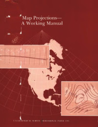
Understanding Map Projections
Melita Kennedy, Steve Kopp
This book introduces and illustrates geographic and projected coordinate systems and offers information on how they can be applied to data. Whether familiar with the science and mathematics involved with projecting geographical data or learning it for the first time, this book will help users understand the difference between geographic and projected coordinate systems. Issues covered include how spheres, spheroids, datums, latitude, and longitude are calculated, the parameters of each projection, and the concepts involved with map projections.
Categorías:
Año:
2001
Editorial:
ESRI Press
Idioma:
english
Páginas:
116
ISBN 10:
1589480031
ISBN 13:
9781589480032
Archivo:
PDF, 17.83 MB
IPFS:
,
english, 2001
 Amazon
  Barnes & Noble
  Bookshop.org
¿Quieres añadir una librería? Contáctanos a través de support@z-lib.do
 Convierte archivos
 Más resultados de búsqueda
 Otros beneficios


Términos más frecuentes
Listas de libros relacionados